
The »Topography of Terror« exhibition has been on display in the centre of Berlin, between the Niederkirchnerstraße (before 1951: Prinz-Albrecht-Straße), Wilhelmstraße and Anhalterstraße since 1987. Located here between 1933 and 1945 were the Gestapo and SS headquarters as well as the Reich Main Security Office. The exhibition presents information on the history of these organisations and the crimes they committed all over Europe.

Berlin, 1933, Gestapo headquarters, Bundesarchiv, Bild 183-R97512, N/A

Berlin, 2010, Topography of Terror Documentation Centre, Stiftung Topographie des Terrors, Stefan Josef Müller
Between 1933 and 1945, situated on the area between the Prinz-Albrecht-Straße (today: Niederkirchnerstraße), Wilhelmstraße and Anhalterstraße were the headquarters of the National Socialist police apparatus. This part of Berlin - the Friedrichstadt - had been home to the Prussian government district since the end of the 18th century. Already in 1933, National Socialist authorities rented the former arts school on Prinz-Albrecht-Straße 8 and set up the Gestapo's central headquarters there. The Gestapo headquarters had their own prison since 1933 containing 39 cells in which members of the Gestapo interrogated and tortured prisoners. Later, further organisations moved to the Prinz-Albrecht-Straße and to the close-by Wilhelmstraße, including the SS and the seat of the Reichsführer-SS as well as the security service of the SS (SD, Sicherheitsdienst). These institutions soon spread to further buildings on the Wilhelmstraße. From 1939 on, the Reich Main Security Office (RSHA) had its central headquarters in the Wilhelmstraße 101-106.
Together with the Gestapo headquarters and the SS headquarters, this area constituted the command centre for the persecution of political opponents and for the murder of European Jews and other victim groups. During the Second World War, the buildings were severely bombed.
Together with the Gestapo headquarters and the SS headquarters, this area constituted the command centre for the persecution of political opponents and for the murder of European Jews and other victim groups. During the Second World War, the buildings were severely bombed.
Berlin, 1933, Gestapo headquarters, Bundesarchiv, Bild 183-R97512, N/A
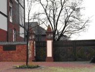
Berlin, 2010, Topography of Terror Documentation Centre, Stiftung Topographie des Terrors, Stefan Josef Müller
The Gestapo interrogated and tortured political opponents and resistance fighters as well as forced labourers and POWs during the war in the prison at Prinz-Albrecht-Straße 8. It is not known how many people exactly were incarcerated here. For most of them, the Gestapo prison was only a transit point on the way to various concentration camps and other prisons. The premises on Prinz-Albrecht-Straße were first and foremost a site of the perpetrators: it is here that the persecution of political opponents was coordinated, this is where the murder of European Jews and of other groups was planned and from where it was implemented. Those responsible at the SS, the Reich Main Security Office and the Gestapo were not simply bureaucrats doing their jobs behind the scenes, they were part of a generation of devout followers of National Socialism with high hopes for advancement. Many high-ranking Reich Main Security Office staff members, apart from fulfilling their administrative tasks, actively participated in the National Socialist mass murder, for example commanding mobile killing squads in the occupied territories in Eastern Europe.

Berlin, May 2009, Uncovered remains of the former Gestapo headquarters at Prinz-Albrecht-Straße 8, visible in the back are remains of the Berlin Wall, Bildwerk, Berlin

Berlin, 2010, Permanent exhibition in the Documentation Centre, Stiftung Topographie des Terrors, Stefan Josef Müller
After the war, the ruins of the buildings on Prinz-Albrecht-Straße and Wilhelmstraße were torn down and the rubble cleared away. After Berlin had been divided into sectors in 1945, the former RSHA premises were located directly at the border separating the American from the Soviet sector. The Soviet part of Prinz-Albrecht-Straße was renamed in honour of Käthe Niederkirchner, a communist resistance fighter. With the construction of the Berlin Wall in 1961, the area became part of the border zone in West Berlin and remained without buildings, partly serving as a waste disposal site. A small part of the site was used as a circuit for car driving practice. The former city centre became derelict. At the end of the 1970s, the area once again came into public attention: the Internationale Bauausstellung (IBA) rejected the extension of a street, planned for 1980, which would lead across the former Gestapo premises. Various citizens' initiatives advocated the erection of a documentation centre or a monument on the former Gestapo premises and fought for a more open discussion about this site of the perpetrators. In 1983, the Berlin Senate launched a tender competition for architectural remodelling of the area, however, the winning design was never realised. The Berlin Senate appointed a workgroup led by Reinhard Rürup, whose task it was to set up a temporary exhibition and make the premises accessible to the public for Berlin's 750th anniversary in 1987. The remains of the Gestapo building cellar, where the prison had been located, were uncovered as well. The »Perspektive Berlin« initiative and its chair Lea Rosh demanded in 1988 the creation of a Memorial to the Murdered Jews of Europe on the premises. In 1992, the Berlin Senate established the Topography of Terror Foundation. The construction of a documentation centre designed by architect Peter Zumthor was begun in 1993, however, it was discontinued in 2004. A new exhibition building opened in May 2010.

Berlin, April 2010, Courtyard of the Documentation Centre, Stiftung Topographie des Terrors, Stefan Josef Müller

Berlin, 1997, Open air exhibition at the Topography of Terror, Stiftung Topographie des Terrors
- Name
- Topographie des Terrors
- Address
-
Niederkirchnerstraße 8
10963 Berlin - Phone
- +49 (0)30 254 509-50
- Fax
- +49 (0)30 254 509-55
- Web
- http://www.topographie.de
- info@topographie.de
- Open
- Daily 10 a.m. to 8 p.m., closed on December 24, 31 and January 1
- Possibilities
- Permanent exhibition, guided tours, educational programme, seminars, library